How Safe Are NYC Streets for Cyclists and Pedestrians?
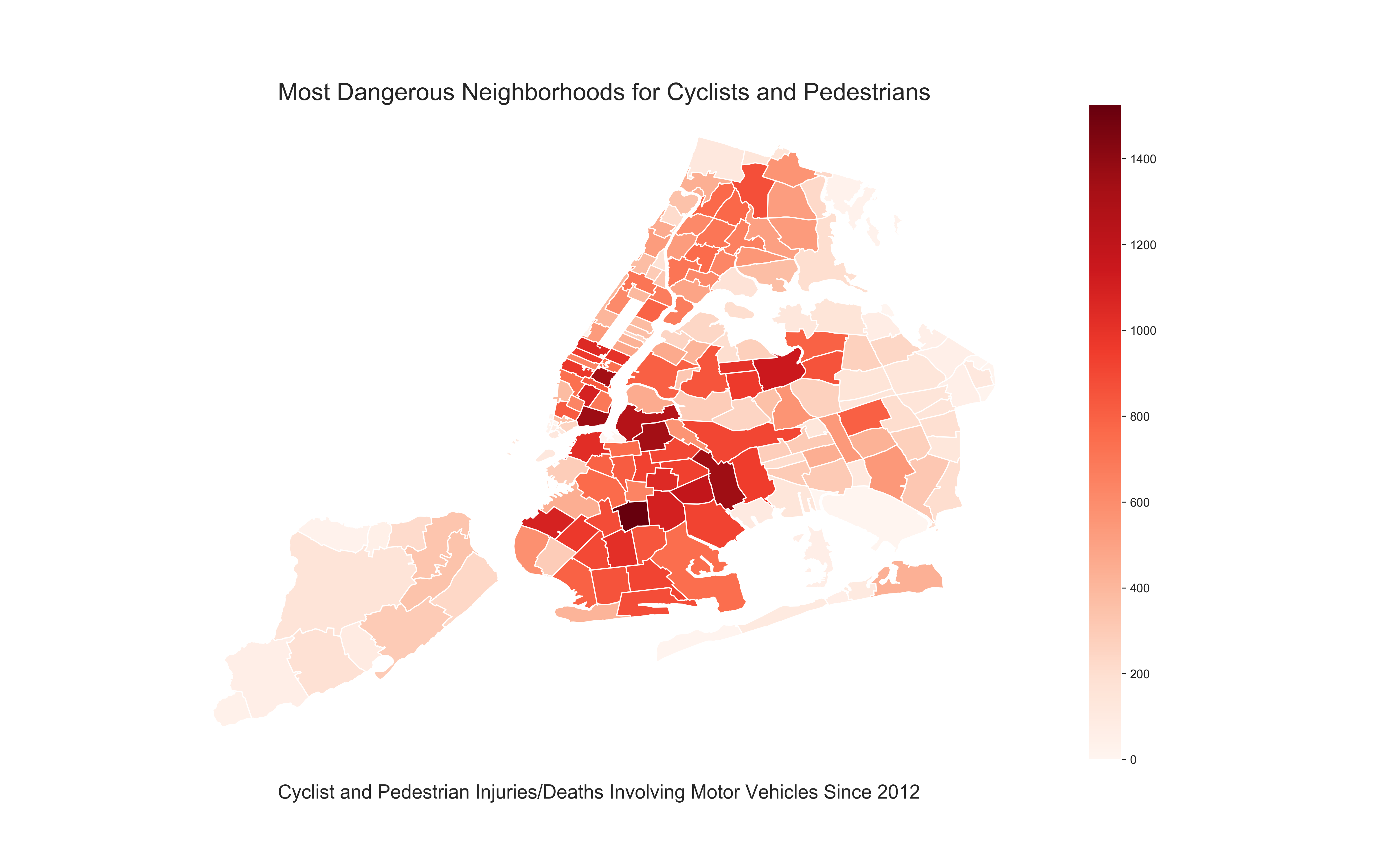
This is a breakdown of every collision in NYC by location and injury. The data is collected as a result of the NYC Council passing Local Law #11 in 2011. Each record represents a collision in NYC by city, borough, precinct and cross street. This data can be used by the public to see how dangerous/safe intersections are in NYC. The information is presented in csv format to allow the user to do in-depth analyses.
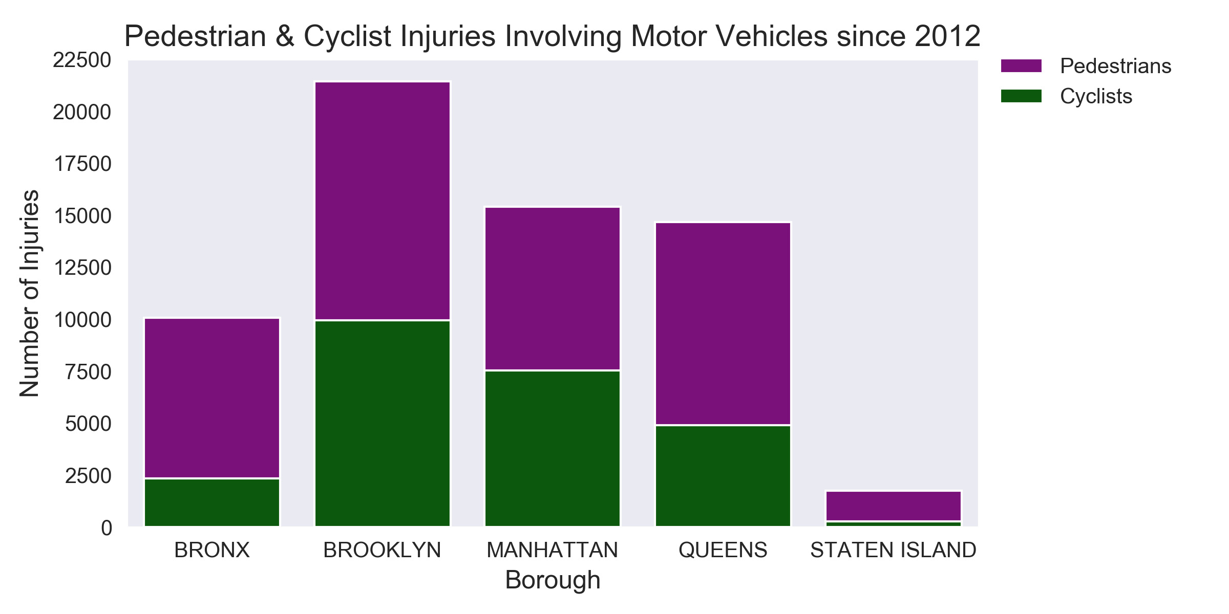
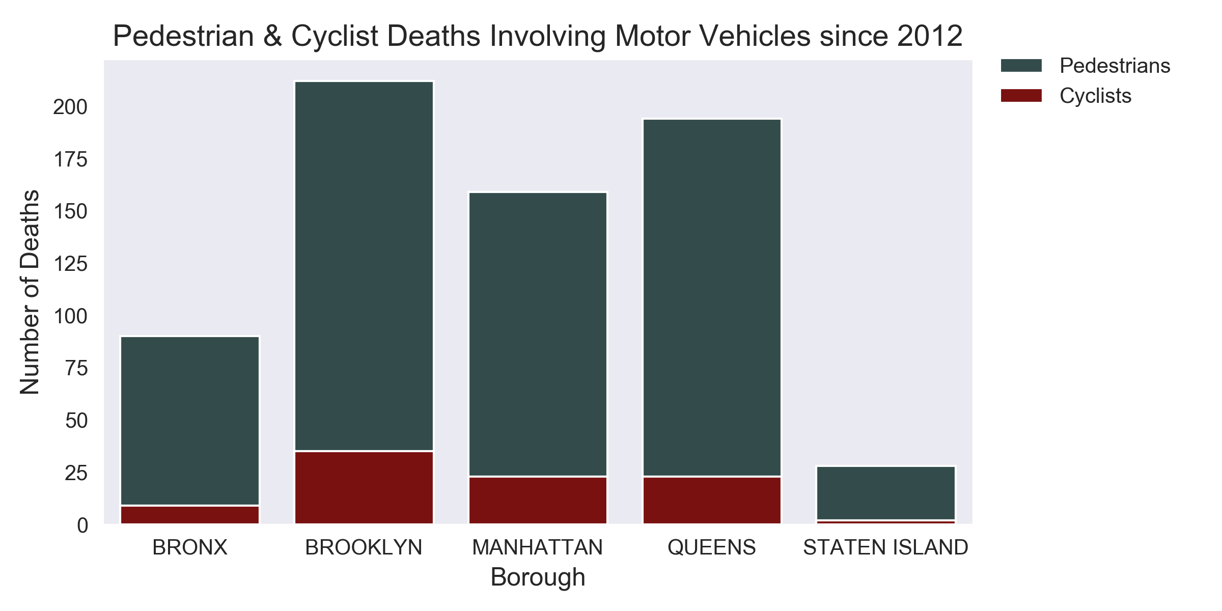
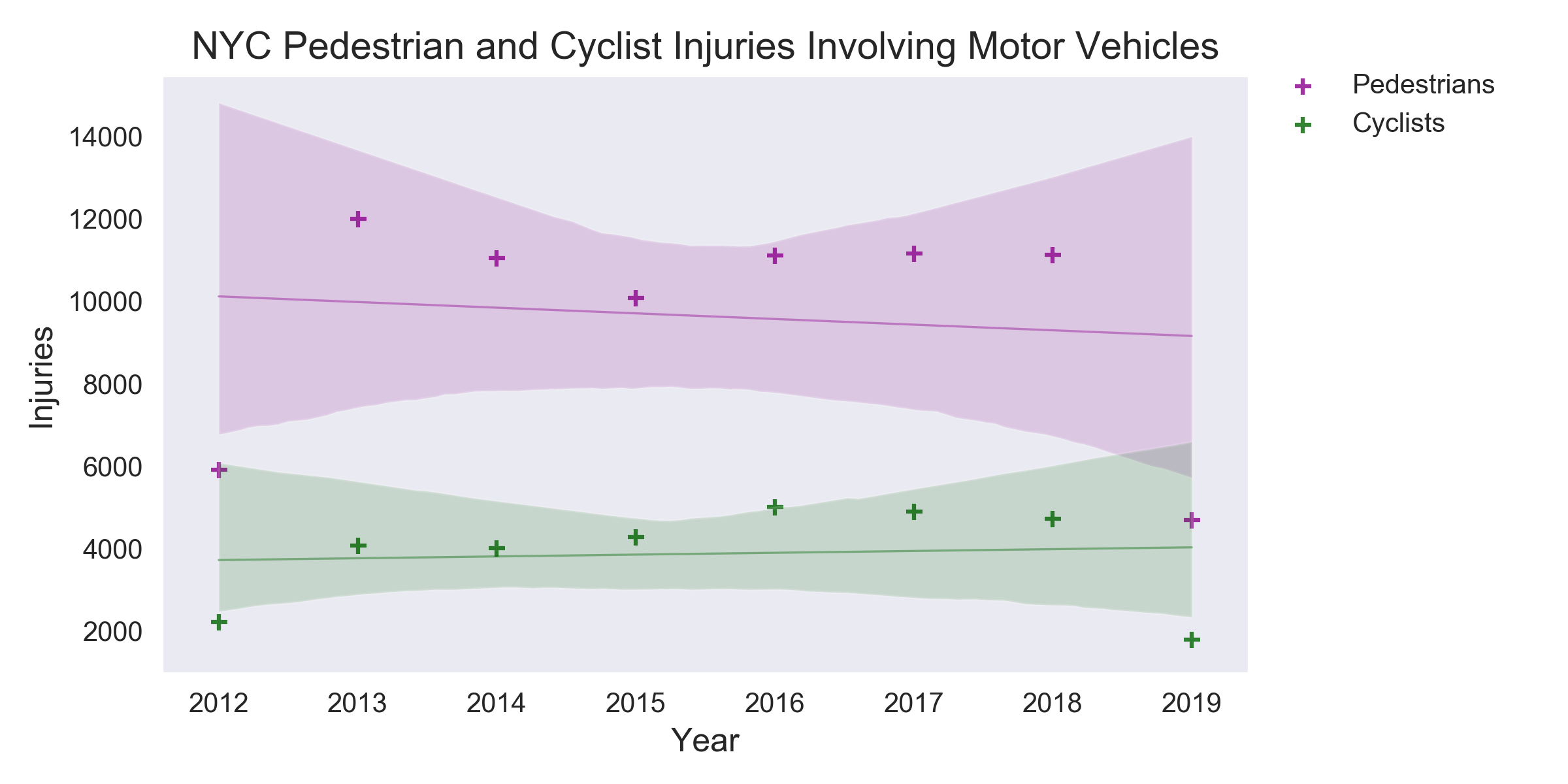
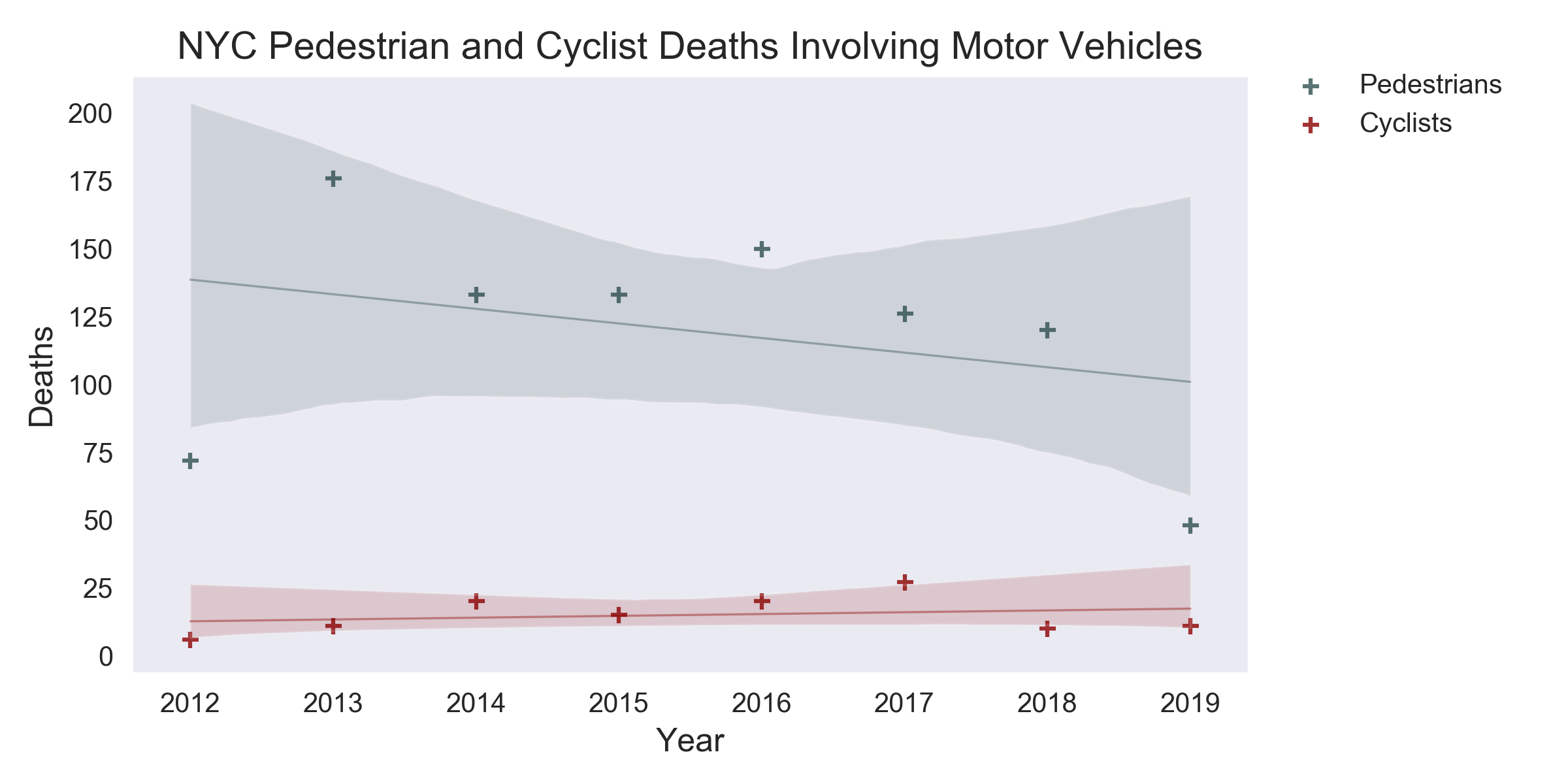
After cleaning the dataset, we analyzed and plotted various aspects of the collision data. Analyses include: injuries/deaths by year since 2012, injuries/deaths by borough and zip code, and the availability of bike lanes by borough. This site provides a sample of the source data and visualizations created as part of the analysis, as well as explanations and descriptions of any trends and correlations observed.
